491
FXUS61 KBTV 152330
AFDBTV

Area Forecast Discussion
National Weather Service Burlington VT
730 PM EDT Thu Oct 15 2026

.WHAT HAS CHANGED...
As of 238 PM EDT Thursday...

No significant changes made.

&&

.KEY MESSAGES...
As of 238 PM EDT Thursday...

1. Quiet before the storm today, and then rain and gusty winds
tomorrow.

2. Cool, breezy weather with some mountain snow on Saturday
will turn drier for the new week.

3. The long term continues to be very quiet with temperatures
at or above normal and high confidence of an extended dry period of
weather likely.

&&

.DISCUSSION...
As of 238 PM EDT Thursday...

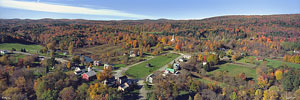
KEY MESSAGE 1: It`s a beautiful fall day out there with chilly
temperatures running about 5 degrees below normal. Winds are light,
and the Sun is shining. Today will probably be the last day for
optimal foliage, because it`s going to get breezy and wet for Friday.

Overnight, a warm front will approach the area. Rain chances will
quickly ramp up as strong ascent from moist air overrunning stable,
dry high pressure produces a solid precipitation shield northwards.
After the warm front crosses, conditions will become increasingly
favorable for gusty winds, particularly in the Champlain Valley.
Conditions are only marginally favorable for mixing, but the
orientation of the winds, and channeled flow between low pressure
reaching Montreal and retreating Atlantic high pressure will favor
gusty winds in and around Lake Champlain. High res guidance also
seems to favor northern slopes near Enosburg and Montgomery Center
in eastern Franklin, as well as East Charleston and Derby Center.
Climatologically speaking, one cannot rule out areas like Malone and
Ellenburg in New York either. Within the aforementioned areas, 35 to
45 mph are most likely from about 7am-1pm. Outside of these, still
plenty of breezy winds 25-35 mph. Combined with the rain, this will
almost certainly take away plenty of foliage, and it may be strong
enough that some localized reports of large branches down and some
power outages are possible. However, south winds are usually not as
impactful given how common strong southerly gusts are in the
Champlain Valley.

By mid-afternoon, the surface low will begin to reach Montreal and
then shift eastwards. The attendant cold front will push southeast.
There could be some convective elements and some type of shear line
that shows up on radar, but instability is marginal and any winds
within precipitation will likely be lower than the ongoing synoptic
scale winds. Still, between the strong warm front and some moderate
rainfall rates likely in the cold front with higher PWATs around 250-
275 percent of normal, we should eke out at least 0.50", even for
most terrain shadowed locations. Totals are most likely to range
about 0.75-1.25", especially across higher terrain. No flood
concerns are expected with the progressive nature of the feature.

KEY MESSAGE 2: Increasingly cool weather returns under northwest flow
Friday night through the rest of the weekend. The backside of the
upper trough doesn`t shift southeast until later Saturday morning.
So with lingering moisture, upslope showers are expected. As
temperatures cool, snow levels will gradually descend as
temperatures fall into the mid 20s to mid 30s. Some snowflakes may
manage to even make it to the valley floor if there are any.
Unblocked flow will generally favor most orographically enhanced
showers near the summits and along their eastern slopes. Approaching
noon, snow showers will taper off as moisture flows out of the
region due to the unblocked flow and upper trough pulling away. Due
to antecedent warmth, most accumulations will be on grassy surfaces
for areas between 1000-2500 ft elevation. Above 2500 ft, snowfall
amounts could approach 1-2".

Temperatures aren`t going to warm a whole lot Saturday as brisk
northwest wind gusts of 25 to 35 mph will remain much of the day.
Max temperatures will be in the mid 30s to mid 40s. So as winds
slacken on Saturday night, we should see most all locations fall at
or below freezing, except for perhaps a handful of spots in Grand
Isle, Vermont and around the immediate shores of Lake Champlain.
South to southwest flow will resume on Sunday, and we will moderate
closer to seasonal norms. The high pressure set up overhead will be
very strong, and appears unlikely to budge anytime soon. Signals are
quite good for a dry spell.

KEY MESSAGE 3: Little change was noted in the 12z guidance suite, which
support expanding mid/upper lvl ridge acrs most of the Great Lakes
and NE CONUS. Did note a weak moisture-starved backdoor cold front
on Weds, which may knock our temps back below normal, depending upon
magnitude of caa. Guidance shows building 1035mb ridge from Maine to
VA by early next week, while closed cyclonic circulation lingers
well east of Hatteras. This high pres is replaced by another 1034mb
high pres over central Canada by mid-week, helping to advect
slightly cooler temps into our cwa for mid to late week. However
with very dry moisture profiles only a few sprinkles acrs the trrn
wl be possible. Temps mostly in the mid 50s to l/m 60s with lows
upper 20s to lower 40s thru most of the extended with dry conditions
prevails. Fire weather concerns will increase next week, due to the
long duration of dry weather anticipated, but winds will remain
mostly light and terrain driven, with high pres.

&&

.AVIATION /00Z FRIDAY THROUGH TUESDAY/...
Through 00Z Saturday...VFR conditions will continue to persist
for the next several hours, with  flight conditions expected
after 06Z as lower ceilings and rain showers move into the
region. By 12Z or so, ceilings are expected to be in the 800 to
1200 ft AGL range, with visibilities dropping between 3-5 SM for
many terminals with widespread steady rainfall. Low MVFR and
IFR conditions are expected to continue through much of the
forecast period, although some slight improvement may be
possible at some terminals towards the end of the TAF period.
Winds will continue to be light at the start of the forecast
period, but will gradually increase out of the south. Strong
south winds will continue through much of tomorrow morning and
afternoon, with wind gusts in excess of 25 to 35 knots
especially in the Champlain Valley. LLWS will also be a major
concern for aviators tomorrow, with all terminals expected to
experience periods of LLWS, starting between 09Z and 12Z and
continuing through much of the forecast period.

Outlook...

Friday Night: Mainly VFR, with areas MVFR possible. Chance SHRA,
Chance SHSN.
Saturday: VFR. Slight chance SHSN.
Saturday Night: VFR. NO SIG WX.
Sunday: VFR. NO SIG WX.
Sunday Night: VFR. NO SIG WX.
Monday: VFR. NO SIG WX.
Monday Night: VFR. NO SIG WX.
Tuesday: VFR. NO SIG WX.

&&

.MARINE...
A new Lake Wind Advisory has been posted for early Friday
morning as south winds increase sharply after midnight toward
sunrise on Friday, especially across the central and northern
portion of Lake Champlain. Light winds this evening will become
south-southeast winds at 10 to 20 knots with gusts 20 to 30
knots toward sunrise on Friday, with waves building 1 to 3
feet. Very gusty southerly winds are expected to continue on
Friday.

&&

.CLIMATE...
Daily low maximum temperatures will likely be broken on Saturday.
Current records are indicated below at some climate sites in
our region:

Record Low Maximum Temperatures:

October 17:
KBTV: 42/1970
KPBG: 44/2015
KSLK: 36/1970

&&

.BTV WATCHES/WARNINGS/ADVISORIES...
VT...None.
NY...None.

&&

$$

WHAT HAS CHANGED...Taber
DISCUSSION...Haynes/Taber
AVIATION...Kremer
MARINE...NWS BTV
CLIMATE...NWS BTV
|